
Scene: a pair of middle-aged dads staring into the blue glow of their laptop screens from opposite US coasts. One is in California, the other Connecticut. They’re on Zoom. It’s late in the evening on a cold winter night, early in the second year of the global Covid-19 pandemic. They are plotting…planning…a journey? An escape? Joy in the face of mutating spike proteins?
“Yo, check this link out…”
“Colorado?”
“Yeah, the 3-day one.”
“Mmmmm…looks delicious.”
“Yeah, look at the description. ‘You get it all in this one – alpine aspen forests, rocky mountain passes, remote high desert landscapes…”
“High desert? Maybe we’ll have a ride where we finally don’t get pissed on.”
Cut to scene:
Well, at least this time the piss was frozen.
PROLOGUE

And so it came that Josh and Jonah—riding brothers from another mother, lifelong college friends, one a late-career ad guy, the other an IDEO-bred design-thinker, and both intrepid moto- and surf-adventurers (with a strange predilection for attracting extreme weather) found themselves scouring the interwebs for their first real travel adventure since the Dawn of the Age of Covid, just as Pandemic: Act I (post-Pfizer/ Moderna but pre-Delta/Omicron) was drawing to a close.
I give you brother Josh, aka Hi-Viz J…

And brother Jonah, aka the Brotherman, aka the Otherman.

Together, you could call them “J&J” (although the former actually got Pfizer and the latter Moderna). Two midlife man-children with an irrational love for playing in the dirt with their two-wheeled toys, who, as the top of this post indicates, were scouring their laptops in search of a post-vax adrenaline fix.
They’d ridden Baja, Utah, California, Wyoming, and even gentle Vermont. But for this ride they’d meet in the middle for a Colorado Motorcycle Adventure—not least because they’d stumbled upon this wanderlust-inducing website.
Jonah: “It says you can camp or hotel. Let’s camp!”
Me: “It’s the Rockies. They have grizzly bears. I’m not fucking camping.”
Jonah: “Why does everything with you come back to bears?”
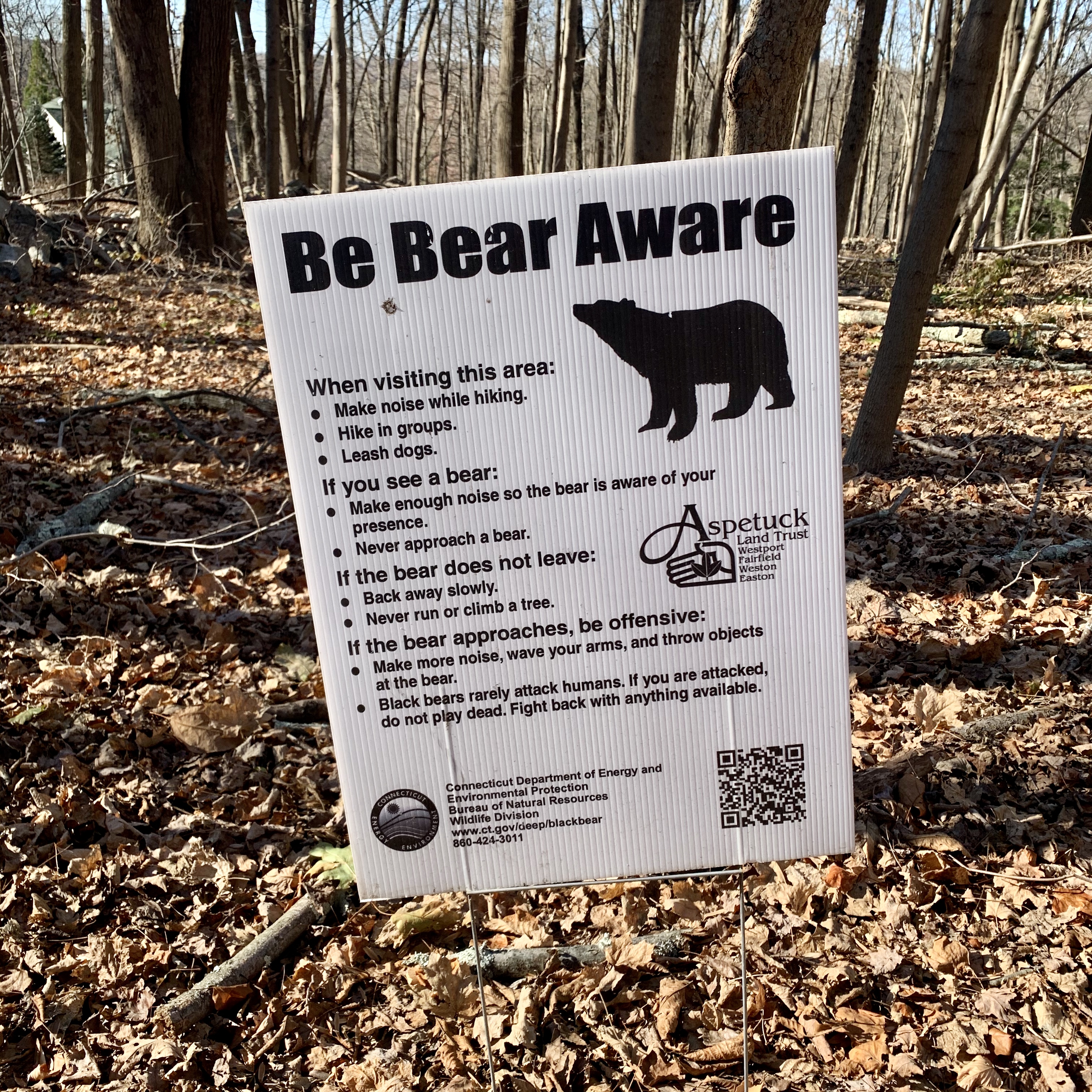
(If you want to know why I live in a state of perpetual moto-ursine-phobia, read my previous ride report: Alone, Stinking, and Trying to Be Unafraid.)
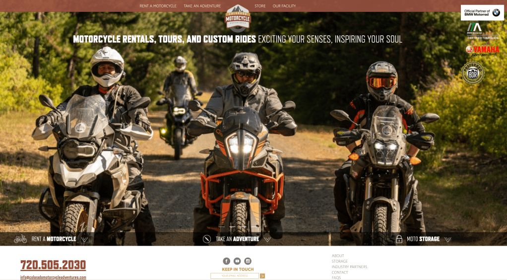
Thus, we settled on hotels. And after a few exploratory calls with Scott Lee—Colorado Motorcycle Adventures’ sole proprietor and a righteous, excellent dude—we set a June date to rendezvous in Lone Tree, CO.
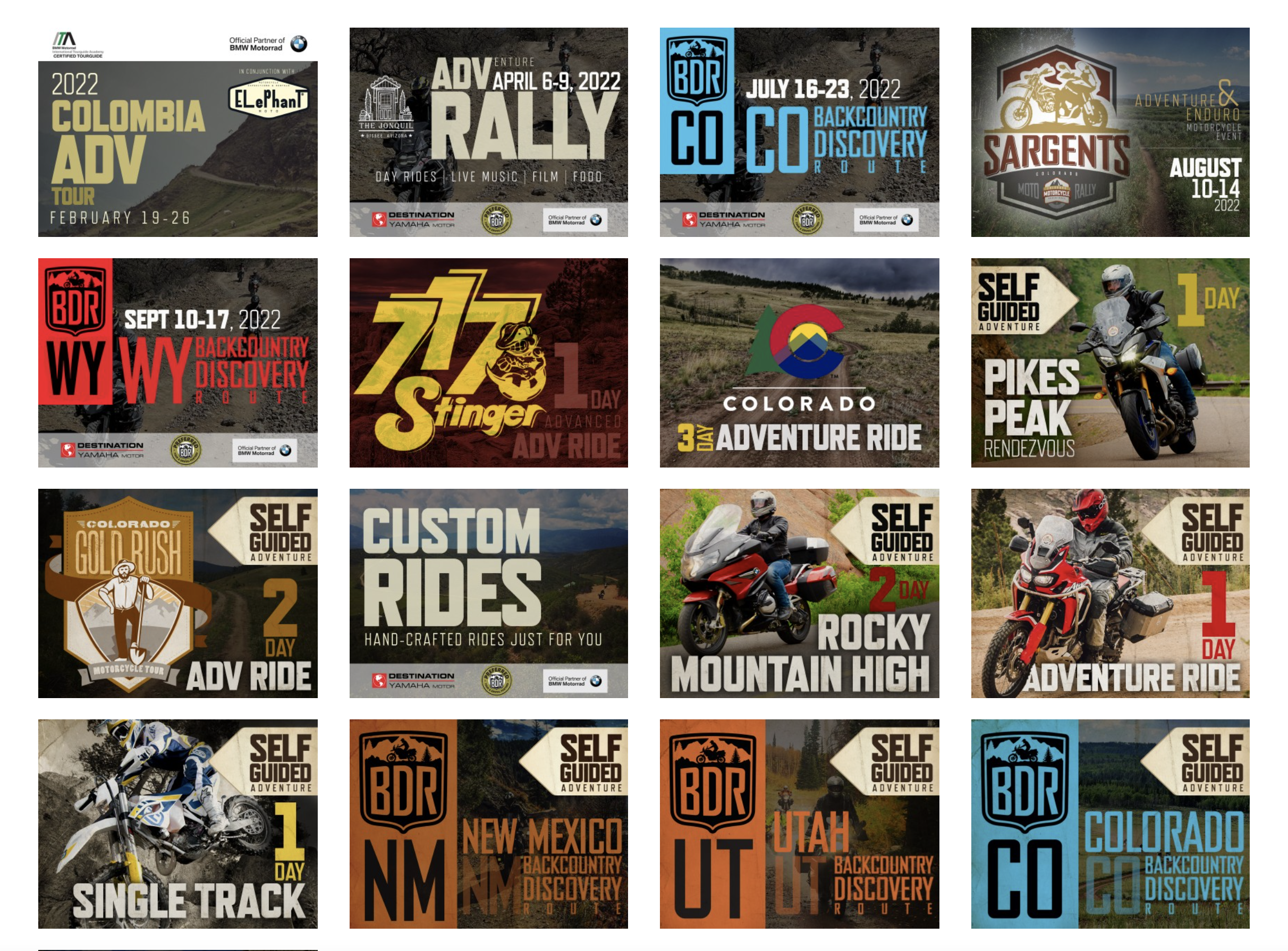
Among the many trip options, Colorado Motorcycle Adventures described our adventure (column 3, row 2) as a “self-guided three-day ride that focuses on as much backcountry dirt riding as possible.”
We made sure it included as much backcountry dirt napping as possible, too.


Gotta rest and water the horses, ya know?
But we’re jumping ahead. So let’s rewind and give you a proper recounting of the ride. Spoiler: no one got killed, no bones were broken (as in previous trips), and no one was struck by lightning.
Hail, yes. But lightning, no.
Forthwith: Hail, Colorado.
DAY ONE
Not only does Colorado Motorcycle Adventures have a natty website. They have a natty site-site, a well-appointed brick and mortar facility in Lone Tree, CO about a half-hour from Denver International Airport.

They store bikes. Rent bikes. Repair bikes. And like us, love bikes. Mr. Lee runs an immaculate, highly professional operation, with a mini shrine dedicated to his very own first ride.


Colorado Motorcycle Adventures even has a “staging lounge” where you can store your civvies and luggage, change into your kit, and prepare to do dirt battle. And when you return, it serves as a post-game locker room to reverse the process—a convenience not to be underestimated.

You not only get to choose your adventure (from one-day jaunts to riding the entire COBDR), you can choose your bikes. I’m partial to Yamahas (back home I ride a Super Ténéré that I’ve taken all over Canada and New England), so we decided to try its smaller, more dirt-friendly brother, the Ténéré T700. (FYI they are awesome).
Scott had the bikes kitted-out with crash bars, bash plates, Wolfman soft panniers, a tool kit on one, and a GPS loaded with the trip tracks on the other.


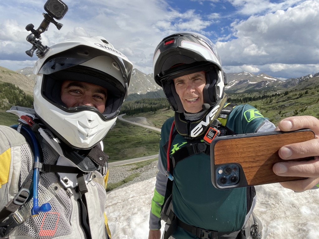
Yes Brotherman, we are actually here in Colorado…and we doing this.

And just like that, these two knuckleheads headed out to ride.

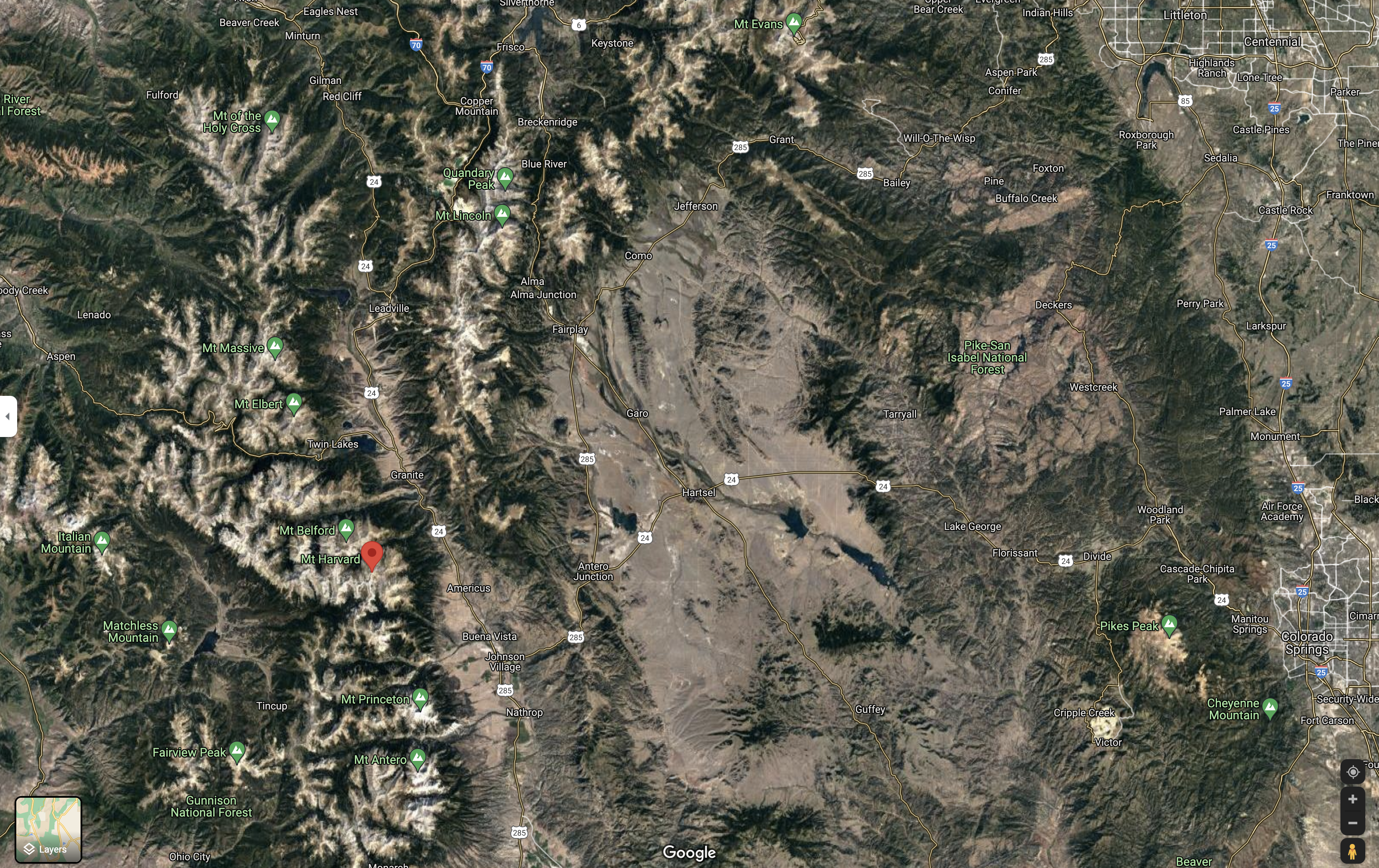
To break it down, we had three full days of riding ahead of us, weaving through the Rampart Range and the Pike-San Isabel National Forest, and up into the Front Range of the Rockies, specifically through the Collegiate Peaks, which include Mount Harvard (14,421 ft), Mount Princeton (14,204 ft) and Mount Yale (14,202 ft).
(We were kind of hoping for a “Mount UVM” after our alma mater, but for scale that would be a speed bump of 4,300 feet—the height of Vermont’s Mount Mansfied.)
This would also be an Adventure with a capital “A”. We’d be riding several hundred miles into the Colorado backcountry (part of the route overlaps the Colorado BDR), outside of both cell service and access from emergency vehicles.
So if you crashed, you’d be SOL without a satellite communications device (we were both riding with Garmin InReach Minis) and medevac airlift insurance (which we both secured before the trip). We were both counting on caution, technology and luck—and all three served us.
Our Day One ride would be 133 miles (90% off road) ultimately landing us in Salida, CO. Just a half-hour outside of Lone Tree we found ourselves among many more trees, navigating sandy trails through stands of Ponderosa, Juniper and Spruce—a stark contrast with the Hayman Fire topography we’d ride through on Day Three.

This leg of the trip through the Ramparts started with puffy clouds, an azure sky, and the occasional rock in the road.


We scrambled our way up to Westcreek, around 7,500 feet.

FWIW, signs like this are a bit misleading relative to the ones you see on the highway. 20 miles on a big dirt bike over mixed mountain terrain—some fast and flat, but much of it sandy, rock-strewn switchbacks—is miles away from covering the same distance on pavement. 20 miles can take a half hour…or two hours. With us, more like the latter.
In time we came across our first water crossing.
Now, in none of our previous trips (over what amounts to a couple thousand miles) had we yet experienced this very literal ADV-riding “right of passage,” piloting our bikes through anything more than a puddle. And indeed, one might regard this first water hole as nothing more than a large one.
But for first timer water-crossers, this is a butt-puckering experience. How deep does it get? What’s the bottom terrain like? What if I drop the bike and can’t hit the kill switch in time? (Hint: you kill the bike).
Here, the Brotherman J puckers on his maiden voyage…
(I know this video us humbling. But it is a testament to hard-coded human assholicity—even among great brothers and friends—that it brings me such delight.)
The second time was a charm. A little wobbly, but a high-and-dry charm.
Fortunately, even as the skies thickened, much of the morning remained a dry, dirty joy.
At one point in the San Isabel, we rode through an area that appeared to be a state-sanctioned, open air shooting gallery. Every quarter mile or so, we’d pass a pickup at the base of a gully—usually littered with bottles, cans and other “target detritus”—and a couple of guys (and women) milling about with rifles or handguns.
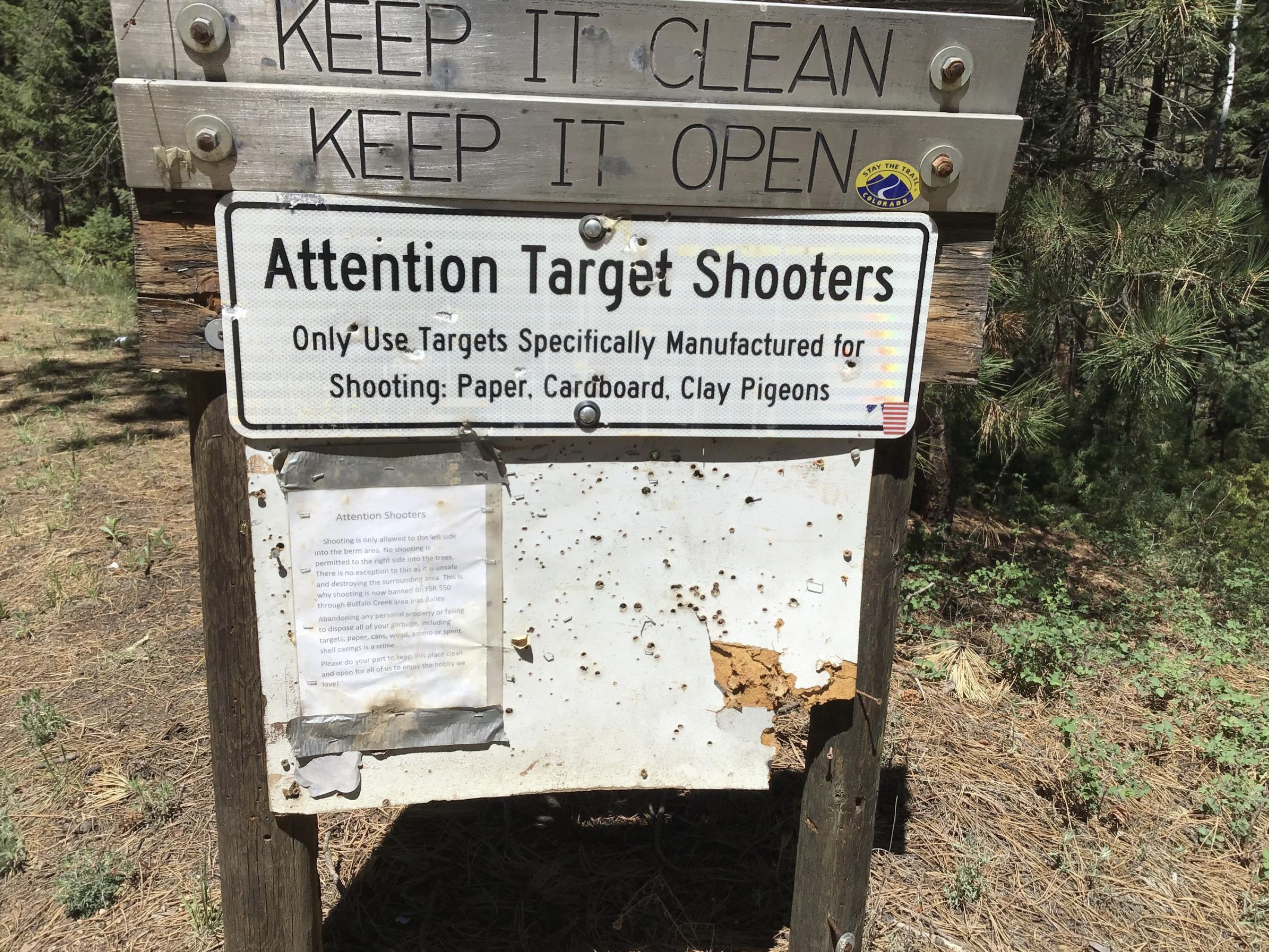
Fortunately, all of these “firing gullies” seemed to be oriented away from the trail, and not towards it. Apparently, this was were Denverites drive out to pop-off, except in the shaded areas which were either deemed too dense or dangerous. Still, a lot of open ground to play Deadwood.
While we avoided the live fire, we came upon a hill-climb that was unavoidable and, on first blush, seemed un-makeable. This is the view down from midway up…

And this is my T7, taking five after not making it. (That’s it—blame the bike, J)

The ground was so loose and steep, it was difficult to climb even on foot (especially in full kit). It was even harder—actually impossible—to upright my bike, solo at least. For grade reference, check out tiny Brotherman waaaaaaay up top…
(I’d sniggered at his water crossing, but guess who was laughing now?)
Even two of us were unsuccessful righting the bike, until a local appeared at the top of the hill in his lifted Jeep Cherokee, and walked down to help us.
Smiling, mostly toothless, and without ever uttering a word, the guy helped us push, pull and shimmy the T7 onto terra-firmer, and pointed it up slope. From there, Jonah volunteered to braap it to the top, and my spent, sweat-soaked frame (and depleted ego) gladly agreed.
Our local hero—who’d hiked back up to the top—then proceeded to tiptoe down the same hill in his Jeep, its bug-like suspension articulating madly like a classical guitarist’s splayed fingers across a dirt mogul-and-trough fretboard. And as soon as he’d appeared, he was gone. Thank you, stranger (oh, and you too, Brotherman.)

We continued threading our way through the Pike-San Isabel, targeting a late-lunch just north of Pike’s Peak at the venerable Mountain Burger Gas Station and Rest Stop in Florissant.
But in typical J&J fashion the weather gods would not let us off unscathed. It started to do this like a motherf*cker:
As the title says, Hail, Colorado—you vast, magnificent, fickle, ice-spewing bitch.
After showing us who the real boss of this ride would be, we finally squirted out of the mountains (and freezing rain), and into the warm arms of Mountain Burger. A Taste As Big As The Rockies.TM

As Inspector Clousseau said, “I would like to buy a hamburger.”

All Hail this one.

And with bellies and tanks full, we hit the trail again.

It dried up for maybe an hour after lunch, with roughly 80 more miles to Salida. The GPS track had us climbing and crossing Currant Creek Pass (9,485 feet). But the earlier hail shower had turned into a soaking rain, and the clay was slick as snot (precisely the conditions where I’d speed-wobbled, crashed and smashed my ankle on our Utah adventure).
One of several naps.


As the trail ascended, two-track became goat trail, the rain intensified, and then—as if on cue—lightning. This has become an unfortunate trademark of our travel experience, dodging Zeus’ bolts in Baja, Utah’s Wasatch, and even on surfboards during a squall in Tamarindo.

Despite my affection for neon garb, I do not like lightning. Especially on a motorcycle. Especially in the rain. Especially at high altitude. So despite Jonah’s “onwards” nudging (he’s the gas), I proposed a u-turn (I’m the brakes) to find a lower-altitude route. He capitulated, and we wound up puttering along this slick, long-ass (and ass-rich) road north to Hartsel.
From there it was a white-knuckle, high-speed run down Route 24/285 to Salida, dodging semis in thunderstorm darkness and pissing rain the entire way.
But at the end of the road, a warm welcome here:

If you ever pass through Salida, the Amigo Motor Lodge is an awesome place to rest your head, dry your kit, crack a beer, and chill in hipster motel splendor.


And so, Day One in the bag. We’d been hailed on. Banged up from dirt naps. Our gear was stinking and soaked. Helmets with enough water to serve as fish bowls. Bikes caked with sand and mud. No cell service. Our asses and quads were sore, and our fingers and toes wrinkled like prunes.
Fucking heaven.
DAY TWO
I woke up the next morning feeling a year older (and I was—Brother J wished me a Braapy Birthday). We were a little bleary from the night before, having Ubered from Amigos to Amicas in downtown Salida for pizza and a few celebratory beverages.
But it was morning in Colorado, the sky was blue, the coffee was strong, and we were eager to ride.

I’ll dub Day Two “The Day of the Passes.” We’d be climbing up the Sawatch Range, and crossing several passes (including the Continental Divide) through some of the highest peaks in Colorado. Around 180 miles all in.
Early on, some high alpine goodness to greet the day.
After passing through Poncho Springs, we headed up to Marshall Pass.

On the way up, we found ourselves in a thick Aspen forest, riding through a fairytale landscape.

And then (absurdly) we stumbled onto the Billy Goats Gruff, blocking the trail. You can’t make this stuff up.

There were 4 or 5 of them, hoofing, digging and gnawing at a hole in the road. We couldn’t tell if it was roots or salt or water they were after. But they had horns, and there were more of them than us.
Fortunately they seemed more focused on the road-hole than the two a-holes on bikes, so we tiptoed past without drama, or paying the toll.
The higher we got, the prettier it became. In some spots, the fields of mountain wildflowers were intoxicating.

We passed the Ranch at Marshall Creek…

And headed up to the Pass, elevation 10,842.

From Marshall Pass we headed to Monarch Pass, then Backstage Pass (I kid, I kid). The weather was a little manic, swinging from steely clouds and spitting rain to this…


Our next waypoint was a tiny mining town called Tincup. The ride in was a banger. Occasionally we’d pass a group car camping, literally in the middle of nowhere, and often with the most unlikely suburban vehicles. How a minivan made it through this without a cracked oil pan is anyone’s guess.
After about six hours of ups and downs through passes, our route took us along a wide, flat loop around a shrinking Taylor Park Reservoir, before a final ascent up Cottonwood Pass and over the Continental Divide. Jonah stopped for a little mid-ride bike chat with a fellow Katoomer (he rides a KTM 690 back in CA).

Not long after that, we came across The Crossing. Over the past two days we’d had a few of those modest water crossings. But now, the trail went up to, and presumably across, a full-blooded river,
I’ve tried to identify it by reverse-engineering our route on Google Maps, and as best as I could tell, this was either the Taylor River or one of the nearby Pieplant, Texas, or Illinois creeks. If our first water hole cause some butt-puckering, this one had my ass soldered shut. We got off the bikes and tried to scout out the best way across…the water was moving faster in some areas, and we had no idea how deep it was.
After about 20 minutes, a side-by-side approached from the opposite bank, and when he emerged, we quizzed him about his line.
Since I was the official cameraman, there was no other option. Jonah would have to go first. Good luck mate!
As you can see, even the width is deceptive, because once you appear near the opposite bank, there’s an entire other tributary section you have to make until you’re out of the drink. Other than a couple of rock hang ups and stalls, the Brotherman navigated like a champ.
All I captured of myself was some shitty GoPro footage of the entry and a couple of stalls. Jonah waded in by a tricky section, in case I needed a wet nurse to help me out.
Like the Brotherman, I made it without a tip. Happy motherfucking birthday to me! Before we pressed on, I had to drain the foot swamp.
We were two proud and stoked motherfuckers.

As if that wasn’t stoke-worthy enough, the route continued to shock and awe. We popped off the trail and onto a perfect paved section, and rode up the ribbonlike Route 209 to 12,000 feet…and the Continental Divide.
I mean, come on!

We were the only bikers among a small gaggle of summer tourists. Even in late June it was pretty brisk up there—especially in our wet riding gear.

And there was still plenty of snow. Note Route 209 descending behind Jonah, which spooled downward towards Buena Vista.

An hour ago, we were thigh deep in a river. Now we were standing on snow up in the clouds.

I decided that I want a dirty snow cake for every birthday here on out.

With evening (and rain) rolling in, we made haste to get down to Buena Vista. We arrived at our intended destination and accommodations for the night, the Super 8 Buena Vista, around dusk. We were both toast, but the crappy reception area should have tipped us off…
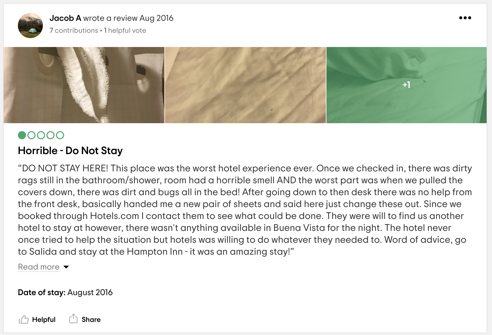
After checking in and hauling some of our kit to the room, we quickly decided to pull the ripcord. The place was so sickeningly filthy and grim—hair and stains on soiled sheets, about a quarter inch of dust on all horizontal surfaces, and bugs around the coffee maker and on the floor—that we loaded our crap back onto the bikes, asked for a refund, and checked out. Here is a sample review from TripAdvisor from 2016. Five years later and I still don’t think they’ve vacuumed or dusted.
FWIW, the only reason we were sent there was because of a large wedding that weekend in Buena Vista, booking up all the rooms in town (and the places Colorado Motorcycle Adventures normally uses). We enlisted Google, and after a lucky call to the owner of A Riverhouse Lodge (a few miles outside of town, just past the Federal Penitentiary) we scored a perfect room in a clean, well-lighted place. We dumped our bikes, called a local taxi-Mom for a lift to some Mexican and margaritas (no Uber here), and afterwards slept like a pair of watered logs.
DAY THREE
Rain, rain, go away. I’m tired of riding in your fucking shit another day.
But a wet day riding still beats just about anything else, especially when it starts with a run through some blasted-rock railway tunnels.
Day three was a shorter, 130 mile run, essentially northeast from Buena Vista, back through Pike-San Isabel National Forest, and ultimately up to Lone Tree. And from the get go, despite a steady rain, the riding was fantastic, even when our GPS reception was not. We found ourselves off-track several times on single track goat trails like this. These were meant for DRZs, not fat heavy ADV bikes. Here, I was tiptoeing down to Jonah, who’d bonked.
Brothers. We pick each other up.
This tip over did some minor damage, including a busted hand guard that was interfering with the front brake lever. A little field surgery and we were on our way.

The trails outside of Buena Vista offered some of the best riding of the trip. Swooping ups and downs, water crossings, sandy berms, whoops, and tractable dirt (once the rain finally let up). We pushed and rode harder for the next several hours more than any other time of the trip.
>>skill building<<
By midday, we’d reached a landscape very different from anywhere else we’d ridden. It sort of looked like a hydrogen bomb had gone off, flattening all vegetation and denuding the hills. Welcome to the Hayman Fire burn zone.

Back in 2002, the Hayman Fire—started accidentally by a woman burning a letter from her estranged husband in a fire pit—scorched over 138,000 acres, making it the largest wildfire in Colorado history. Put into moto-distance perspective, that’s over 200 square miles.
Nearly 20 years later, the area is still eerily treeless, but starting to fill in with green and low scrub. As my late dad used to say, “nature abhors a vacuum.” Indeed it does.
Brotherman J, surveying signs of life pushing up through the desolation.

Doo rag hiding my thinning pate. There’s no hiding for the landscape, though.

The riding through this burn zone was relatively fast and flat, with the occasional sweeper opening up more of the martian vistas. Out track essentially took us down into the valley below, and then up and over the opposite ridge.
As we left the burn area, one section gave us some guardrail-less thrills (so long as we didn’t spill).
By mid-afternoon, we were adequately crusted with dirt, and ready to descend down to pavement and back to civilization. The bikes looked like this now, but the skies would open up again shortly, and our last 30 miles back to Lone Tree would be—in keeping with our foul-weather riding traditions—in spitting rain.

At least we returned the bikes clean.
Here’s the final tally: just shy of 500 miles of off-road riding in three solid days.

Back at Colorado Motorcycle Adventures, it felt great to change out of our sopping wet kit and into warm, dry street clothes.

We both used our Garmins to send “back safe” messages to our SO’s, and then headed to a Hilton for a steak dinner, some WiFi, and sleep.

Next morning it was Uber to DEN, hoofing gear to the gate, and back to our respective coasts.
But before we headed to our gates, I managed to snap this picture of Jonah in front of a statue of Jack Swigert, Jr., Apollo 13 astronaut and Congressman-elect from this great state. Hail, Colorado.
And it occurred to me…

Every time we go on one of these adventures, riding out into the wild—navigating nature, uncertain terrain, unpredictable weather, and our own uncertainty, hesitance, and private fears—it feels like we’ve flown to another planet and back again. Like we’ve pulled off something mildly crazy and ridiculous and joyful and a little dangerous. Like we’ve done something really exceptional, and lived to tell the tale again.
It’s unlikely either of us will ever see space from the inside of a capsule in our lifetimes. And that’s okay.
I’d rather fly outside.

One response to “Hail, Colorado”
BEYOND cool!!!!!!!!!!!!! You guys made the most of some pretty crappy weather to say the least. Next time I’m coming!