Before undertaking an eight-day, 2,000 mile moto-camping adventure into the wilds of Quebec this summer, I consulted Reddit about the one aspect of the trip that was gnawing at me.
Bears.
Here’s what one kind Redditor had to offer in the way of self-preservation:
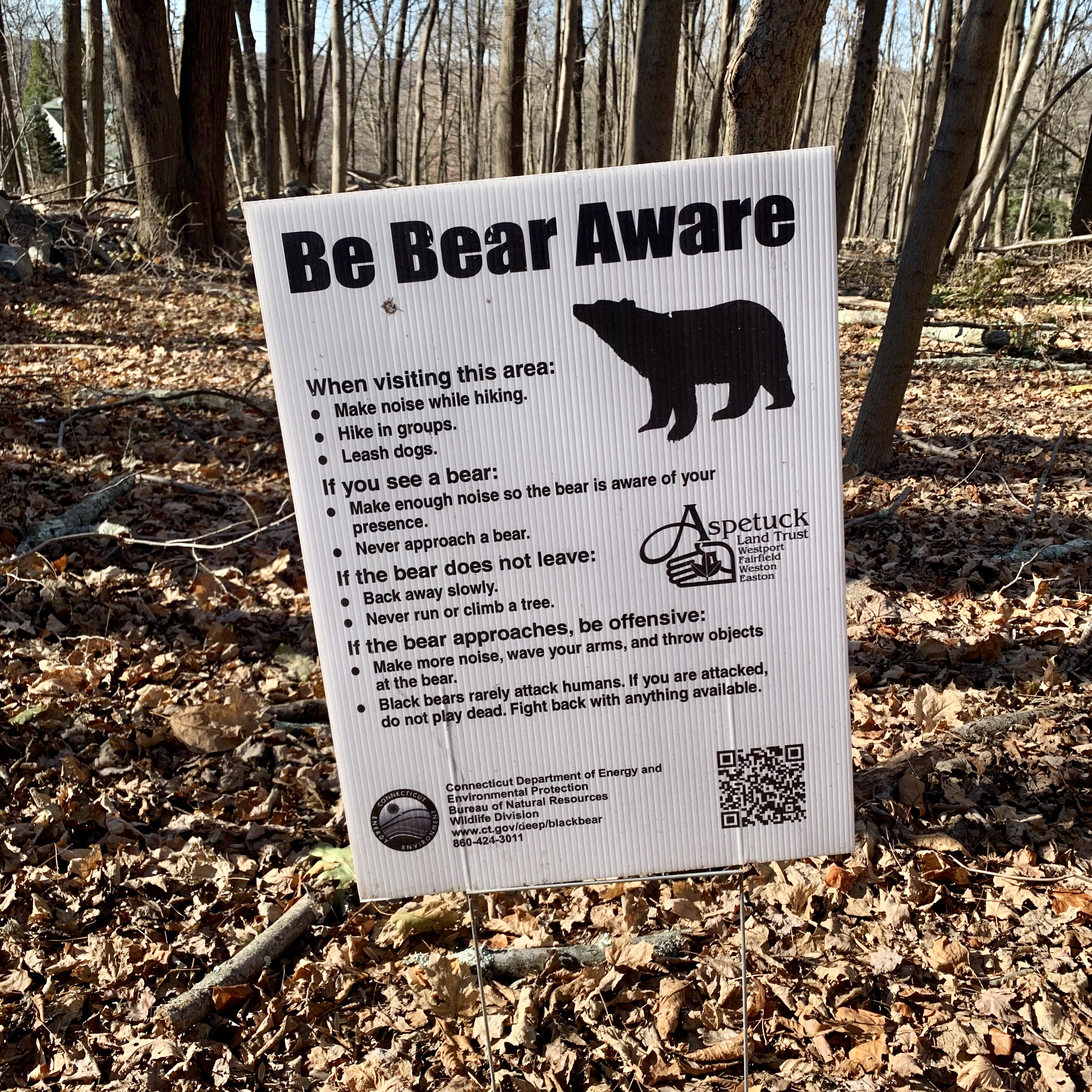
“When setting up camp, don’t eat, brush your teeth, or pee/poop near your tent. Keep food scraps/trash etc in your pannier and dispose of them on the road the next day. If you wash dishes, use a stream (no soap), or just wipe them off with a rag and keep it with your trash. I wouldn’t bother about wearing deodorant at night. Get some unscented stuff or sleep in a sleeping bag liner to avoid getting it too stanky. At night, at the very least keep your pannier away from your tent; best practice is to hoist it into a tree using some paracord or similar. But if it’s reasonably bear-proof (won’t pop open after being tossed around) you could just tie it to a tree so a curious bear doesn’t knock it away.
Prologue: My Thing With Bears
This kind of advice, while helpful, makes me more likely to poop or pee in my tent out of abject fear, especially since I’ve already had a few odd, unsettling encounters with Ursus americanus, none of which even involved deodorant.
For starters was a solo ride to Vermont the summer after Hurricane Irene. Whole sections of Route 100 (along with many historic covered bridges) were a post-apocalyptic wreck, leaving parts of the state looking like a set from the Walking Dead. Idyllic, for sure. But definitely Walking Dead.

As it turned out, all of the paved GPS routes to my destination were disrupted or closed, so like moto-Goldilocks I chose a path through the woods. And guess what I found?

This guy, out foraging for a motorcyclist to maul. I couldn’t make out if it was a cub or mama bear. But when it took a few curious steps in my direction, I didn’t wait to find out.
Another weird co-bear-incidence: a friend’s son was involved in an actual, serious bear attack in Alaska while taking part in a NOLS outdoor leadership course. Four kids suffered bites and one was badly mauled but survived, thanks to my friend’s son’s cool head, EMT training, and quick action.

Seeing a pattern?
To be fair, that was Alaska; the deep outback; a grizzly; and not even me. But other than that, a very close pattern, reinforced by yet a third bear-scare, this time with my wife during a winter camping trip to Mt. Greylock.

We were hiking through snow-covered forest, enjoying the muffled silence of the New England woods. The only sound was our breathing and the crunching of boots.
Suddenly, the hush was pierced by a low, threatening growl. We froze.
Our eyes darted, trying to locate where it was coming from. It grew louder, but we couldn’t triangulate anything besides the trail and the snow-caked trees that surrounded us.
The piss-or-shit, fight-or-flight response kicked in, and we edged backward, retreating slowly at first, and then scrambling back to our camp soaked in cold sweat.
Had we awakened a dozing bear? Stumbled on a coyote den? We never did find out. But in addition to our mouse-infested camping cabin, “the incident” made for an edgy rest-of-trip, and I consider it the third strike in my bear-wariness.
Thus: moto camping? Solo? The Great North Woods? Bear. Move four clicks up the alphabet and you know what you get? Fear.
Which brings me to the eponymous theme-song for this journey, an epic balls-in-the-face-of-fear anthem from a voice that often guides me on these journeys (other than my Garmin GPS): Robert Pollard, the amplified-to-rock, latter-day Beethoven behind the band Guided By Voices:
For me, Alone, Stinking, and Unafraid—with Bob’s beer-tossing, chain-smoking, devil-may-care defiance—is the ultimate sonic F-U to fear. It’s the perfect tonic for those nagging questions (some neurotic and irrational, others well-founded and totally legit) that tend to haunt my planning for this and every other motorbike adventure.
“Will I be able to go the distance? What happens if I run into mechanical issues? What if I crash in the woods, 100 miles from cell service? Or get creamed on the Interstate? Will my ass survive the mileage? Will I be able to sleep? What if I have a gout attack? Or a…bear attack?
I suppose the only way to avoid those fears entirely would be to not go on motorbike trips in the first place and to learn to content myself with more domesticated pleasures like pilates or golf. Which is unlikely to happen (sorry, Liebe).
So humming my thematic booze-rock variant of another old song, I set out to pack up my troubles in my old kit-bag (less the deodorant, which is—according to Reddit—like catnip for bears) and smile, smile, smile.
Packing and Racking
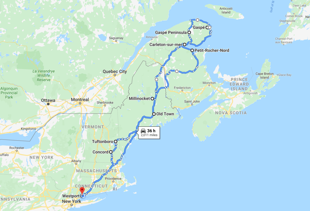
Preparing for this ride presented a new series of challenges. I’ve done plenty of multi-day trips before, but never with this much mileage (about 2,400) or over this many days (eight). I’ve ridden up, into, and throughout New England, but never as far north as Aroostook County, nevermind the Gaspé in Quebec.
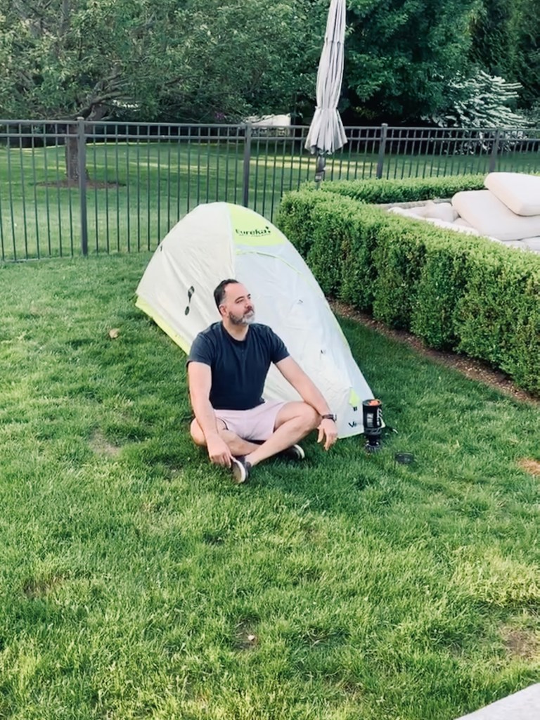
And while I’ve camped in my backyard with my kids, I’ve never solo-camped in a micro-tent, unless you count this controlled backwoods experiment by a small body of water (aka the pool).
So figuring out how to pack and achieve total motocamping self-sufficiency took incredible planning, organization and discipline, which looked something like this:

Between two panniers, a Giant Loop Tillamook Dry Bag, my tank bag, and a bunch of Rok Straps, I’d be portaging everything I’d need with the exception of water and gas. In other words: tent, pad, tarp, sleeping bag, JetBoil camp stove, canteen kit, fire starters, food that could last most of the trip (including canned and dehydrated food), energy bars, a coffee setup, and a minibar for wind-down (plastic flask of Basil Hayden).
Tool-wise I took the usual suspects, including a very basic wrenching kit, Leatherman, tire plugs and patches, a Slime electric tire pump, zip-ties, and Gorilla tape. I’d also need a mix of warm-cold-wet-dry gear, since I was departing during an epic heatwave in the NYC metro area (with daytime temps over 100°F), but with evenings on the Gaspé forecast to be in the upper 40°s.
The one thing I never got around to? Bear spray. Go figure.
So here was the plan: ride from southwestern Connecticut to the top of Quebec’s Gaspé Peninsula via Maine and New Brunswick, then back down via Maine and New Hampshire, and finally (bear-gods willing) home to CT. Roughly 2,000 miles according to Google Maps, before detours, tangents and screw-ups.
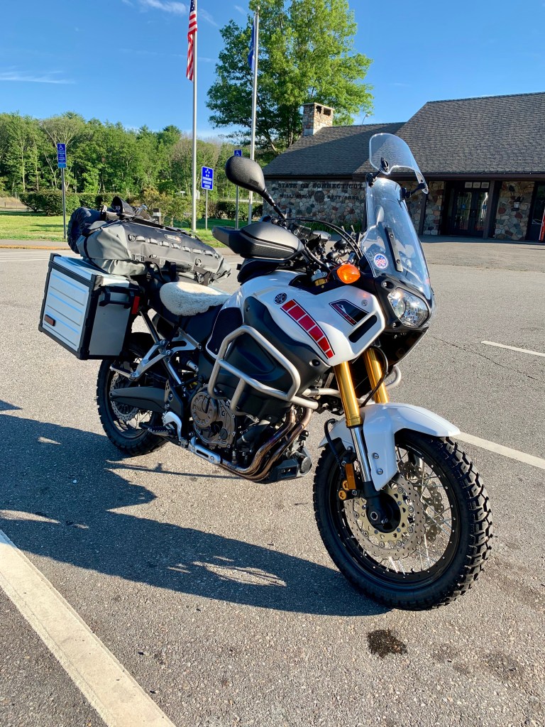
My chosen biké for this Gaspé ridé would be my trusty Yamaha Super Ténéré, which seemed tailor-made for the trip, given all accents aigu. Here she is all ticked and tied for a 5 AM departure.

For the bike-curious, those are Alt-Rider crash bars, that’s an Alaska Sheepskin covering an AirHawk seat pad (butt of course), and I’d be rolling on Heidenau K-60 Scouts, which came home from this trip a lot less round. For guidance, I used a Garmin Zumo 390 and my RAM-mounted iPhone, talking to my head via Sena bluetooth.
So enough gear-noodling, hand-wringing, and bear-obsessing. As they say on the Gaspé, On y Vas!
Day 1: Westport, CT to Old Town, ME
435 miles

Au revoir, Emily et ma famille! Souhaite moi bonne chance!
Ladies and gentlemen, I give you your host to the coast.

Here’s my battle station for the next eight days, just before takeoff.

Day one was a long-ass haul, 400+ miles (mostly slab) from southern CT to Old Town, Maine. Much of the ride was predictably dull and not report-worthy, just several hundred miles of I-95 dodging trucks and stopping at State Welcome Centers to pee.
But one of the principal virtues of the Ténéré is that it eats miles for breakfast, which it did heartily.
When I crossed into Maine, the human pilot needed some breakfast, too. So I peeled off to visit the aptly named All Day Breakfast in Kennebunkport.

“Fill’er up, please.”

I couldn’t leave Kennebunk without riding by Gooch’s Beach, which we often visit as a family in the summer. It was a little weird being there without my wife and kids, in a riding suit rather than a bathing suit. So I texted them this shot of me soaking up the sweat, if not the rays.

At this point I still had another 175 miles to go, so back in the saddle. I rolled into Old Town in the late afternoon, following the GPS to my destination.
Old Town, home of Maine’s famous Old Town Canoes (manufactured here since 1898) is now, like many New England mill and river towns, worn and rough around the edges, a bit like the faded, upside-down canoes you see covered in grit, sap and pine needles lying unused next to decrepit garages throughout the state. While the Penobscot here is still pretty, and the banks green and lush in July, Main Street (running alongside it) is commercially arid.
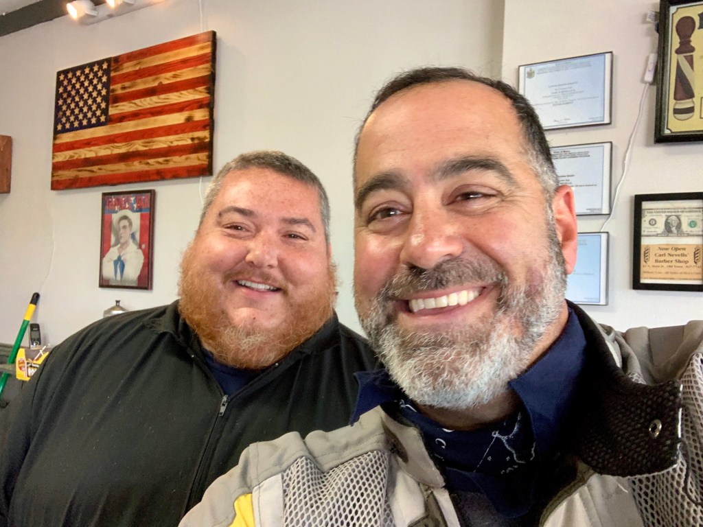
But I did find a patch of life at Gus’s Barber Shop, where I had my head adjusted for more a streamlined helmet fit by the man himself, who appeared to know every other customer by name.
After getting my ears lowered, I headed for my final destination. For this first night of the journey (and after a 400+ mile day), I had planned on not camping, opting instead for a farmhouse AirBnB near the Orono town line, over by the west branch of the Penobscot.
Here’s the welcoming party at Clear Light Farm, home for the night.
The setup was quiet, lovely and immaculate.


My host, Andrea, a retired ER nurse from Massachusetts, was as kind as she was wise. She’d left the harried urbanity of Boston mid-career to forge a more holistic, farm-based life in Maine working as a home-birth midwife, often on the Penobscot Indian Island Reservation. If you’re ever in the area, consider staying with Andrea. She’s a super cool human.

While unpacking, I had the first (and only) equipment failure of the trip. The lock on my right-hand box somehow decided to nosedive into the pannier, leaving the other half stuck to my key, and me stuck with an unlockable box.
I tried every tool from Andrea’s well-equipped bench to fish out the lock, but no bites.

Which led to this: when in doubt, pry it out.

For the remainder of the trip, I’d have to use Rok Straps to secure the lid. But at least I could access clean underwear. And the “field repair” gave me the (very false) confidence that even if I blew a cylinder gasket, I could repair it with some Gorilla Tape.
(At least I’m aware of my self-delusion).


On my host’s advice, I took a ride past the University of Maine in Orono to dine at Woodman’s Bar & Grill.

Not bad for a bar in Maine: salmon and quinoa, washed down with beer & lemonade.

But to really celebrate the start of my journey, I decided to stop at the Queen and reward myself for a successful first day.

The very picture of moto-travel happiness. Day one, done.

Day 2: Old Town, ME to Petit-Rocher-Nord, NB
342 miles

Cock of the mornin’ to you.

Time to pack and saddle up.

Farewell, Clear Light Farm. Thanks for the awesome breakfast and good company, Andrea. Here’s the road out of (Old) town.
The Maine Turnpike (aka I-95) north of Bangor up to the Canadian border is my kind of highway. Other than the occasional semi or pickup, there’s hardly a vehicle in sight. It’s beautiful, fast riding through scrubby, northern New England countryside, fields and lakes punctuated by copses of squat evergreens, and it was sunny, clear and warm.
I stopped for a few snaps in eyeshot of Mount Katahdin, which I’d be skirting closer to on my trip back south.


An hour or so later I crossed the border at Houlton, and continued up into New Brunswick.
My route took me north up CA2 through gently rolling farmland, forest, and potato country which I’d also revisit on my way back down…
It was during this leg of the ride that I had my first wildlife encounter of the ride. Not a bear, but a moose.
There were roadside warning signs for moose all along CA2; but despite scanning the shoulder and hoping for Bullwinkle (I’ve ridden all over New England but never laid my eyes on one), nada. Until one of those giants stepped out of a thicket about 100 yards ahead of me, working a steep thicket and munching leaves.
I panicked trying to get to the shoulder to stop the bike and pull out my iPhone for a picture. But by the time I got my glove off, the elusive creature slipped back into the thicket like a land-whale flipping its tale and heading for the deep.
So no pic. But it did happen.
Just past Grand Falls, I peeled east to follow Route 17/180 out to Chaleur Bay, the whale-filled body of water which marks the underside of the “lobster claw” of the Gaspé.
At this point, I was getting pretty high up into New Brunswick when I saw this. And had to stop to check it out.

Pot (as all the world knows) has been rendered recreationally legal across all of Canada, and Cannabis New Brunswick was one of the new state-run retail dispensaries. While I don’t partake (the stuff makes me anxious and paranoid; I’m more of an old-fashioned bourbon guy) I had to check it out.
Once you get past the ID scan and into the actual shop (there’s no signage or advertising until you’re inside) you feel like you’ve entered an Apple Store, except it’s for marihoochie. It was the exact opposite of my mental picture of a tie-dye and bong “head shop”— immaculate, brightly lit, with blond wood and glass counters, and staffed by cheery retail salespeople. All the wears are displayed beautifully, and informatively labeled. They don’t allow photography, so sorry no pictures.
I had an interesting conversation with one of the “cannabaristas,” a young woman in her early forties and admitted lifelong pot enthusiast. I asked her how business was, and she confided that for all the store’s hype and polish, it was turning into a bit of a bust.
In her estimation, despite all of the efforts at creating a normalized, mainstreamed appeal for weed (and thus a thriving, taxable revenue stream) they’d experienced a much slower-than-expected start to the business. The Government—in her opinion—was trying too hard to turn pot into a higher-end ‘connoisseur’ experience (along the lines of fine wine or specialty coffee), but most Canadians weren’t buying it. Literally. She thought most folks still wanted their pot “fast, easy and cheap,” and estimated that many people—especially young ones—were still buying outside of the officially sanctioned “iPot” retail channels, opting for local black market weed instead. Just like before legalization.
“I mean, leave it to the Government to blow it on pot!” she snorted.
Thus, my cannabis curiosity satisfied, it was time to, uh, roll.
For my second night, I was planning on tenting it. I rolled into my destination, Petit-Rocher-Nord (a kind of Acadian version of Hyannis Port on Cape Cod) in the early evening, and found my way to Camping Le Petit Rocher, the family-owned campground where I’d reserved a site overlooking the beach.
It did not disappoint. I fired up the JetBoil for some quick chow…

And pitched camp.

I still had plenty of daylight…

…to enjoy the bay and channel my inner Crystal Rock lady.

As dusk arrived, so did the skeeters and black flies. This kid (15 bucks on Amazon) actually helped.


When evening rolled in, so did some clouds. Which had me nervously checking the weather app on my phone before I turned in for the night. It showed about a 40 percent chance of rain overnight, so I made sure the tent cover was secure, had a nip of bourbon, and hit the sack.

Around midnight I was awakened to this. (Sound up for fun.)
This wasn’t just “rain.” It was more like the stormpocalypse. Wind was bending my tent horizontal, and the rain felt more like hail. Lightning was also flashing. I had to reach outside to hold the aluminum stake that secured the storm-flap to keep it from launching, which was like holding a lightning rod steady to make it easier for God to strike it.
Lying there with one arm outside in the maelstrom and the other in the tent, I used my free hand to check the radar, alternately pushing against my tent’s wall to keep it from folding. According to the weather app, my nylon Noah’s Ark would be squarely in the storm’s rolling bullseye for the next, oh, 2-3 hours.
As the say in these parts, merde.

It was not what one would refer to as a “restful night.” On the plus side, and for my first night camping:
1) the tent didn’t leak
2) I was not blown out to sea
3) God mist have found another piece of metal to play with, and
4) no bears?
Day 3: Petit-Rocher-Nord, NB to Percé, QE
205 miles

Needless to say, this piece of metal woke up so wet you could wring it out.

Another app-check revealed the rain would be hanging around all day …so it was into soggy kit and on with the neon rain suit to keep me from totally water-logging.
Still, there was still plenty of water, and logging.

In order to go “out” to the Gaspé I first had to ride “in” towards Campbellton, and cross a bridge from New Brunswick into Quebec. I took a brief lap through town.

As my folks used to say, if you don’t have something nice to say, don’t say it. So no comment.
Once on the Gaspé, I essentially made a U-turn and started heading east along Quebec Route 132, the coastal ribbon of road that wraps the entire peninsula like a bow. Parts of 132 (in particular the Atlantic and Saint Laurence facing portions) can be breathtaking. But the morning’s southern section along the Chaleur Bay? Not so much.
The area’s greatest virtue seemed to be that, well, it faced water. But it felt a bit like the Jersey Shore of Quebec. The landscape was generally flat and dull, punctuated by commercial strips and seaside vacation homes whose architecture could best be described as “hostile-eclectic.”
Mash pastel clapboard together with a random melange of stone and brick facades (never one or the other—had to be both), add wrought iron railing work, mismatched, ill-sized windows (always with one baroque “statement” portal enhanced by fancy frosting and etching), a colored roof and, say, a turret, and…you get the effect. There’s a Yiddish word for this: ungapatchka.
A well-dressed colleague of mine once commented that one should never leave the house wearing more than one article of “statement” clothing. Just one. Pick one. A swank pair of shoes…a daringly-lined blazer…an unusual shirt…an assertive watch or belt. Just one. And only one. Any more than that, and you start to look like Danny McBride in Eastbound and Down, or Elton John. The houses along my ride looked like the conspicuous lovechild of both.
To be fair, Mr Spaceman here in his hi-viz neon rain condom was not exactly the picture of moto cool. But I was trying to avoid getting hit by rain, and vehicles that skid in it.
When I finally got to Carleton-sur-Mer, I was soggy, cold and jonesing for a hot coffee. Le Héron hit the spot.

While Carleton is definitely “sur Mer,” it also has a minor mountain sticking up right behind it, so after drying out, I went to explore. I followed a steep and winding road up to Oratoire Notre-Dame-du-Mont-St-Joseph, a Catholic (and moto) pilgrimage and chapel on the peak of Mont St. Joseph, overlooking the Chaleur Bay.


A kind German tourists captured me doing my “can we stop with the rain already?” dance.

But the sky was still being an Assel.

I kept wending my way up 132 towards the eastern tip of the Gaspé, hoping for a break in the weather. But every time it looked like things were drying out…

…the sky reloaded. So by the time I arrived in the town of Percé, I was having serious misgivings about spending another night in a wet tent. So I decided to abandon my plan to camp, and opted for a dry room at Hotel La Cote Surprise, a sweet little motor lodge right on the crest of the hill as you enter town. Practically every room has a terrific view of the famous Percé Rock.

I don’t know which made me more excited: having a warm, dry place to wring out my sodden kit; getting to take a scalding shower; or exploring the rock, the town, and the dining options.
I started with the iconic rock, which is indeed pierced (who isn’t these days?) and impressive.

I left my bike at the central parking and picnic area, and strolled up and down Percé, looking for a place to eat. It’s not unlike, say, Kennebunkport, Maine, a compact, charming, but somewhat touristy strip butting right up against the water. There were plenty of bars and restaurants, but mostly from seaside tourist-strip central casting. So I did some googling and wound up on a quiet side street here at Comptoir Monsieur Emile, which bills itself as “un bistro gastronomique.”
And it was indeed “magnifique.”

And while the rain had put a little damper on the “adventure” part of my camping adventure, I’d be lying if I said I wasn’t giddy about going back to La Cote Suprise and spending the night in a warm, dry bed.
A little Sancerre, an interesting deconstructed Caesar Salad, a delicious piece of sea bass, and I was in Percé-heaven. I raised a glass to being almost 1,000 miles from home, with no mistakes, and no bears.
Day 4: Percé, QE to Forillon National Park, QE
70 miles

It was nice to wake up to this.

The weather gods were finally smiling today, and it was a joy pulling on dry socks, dry clothes, dry helmet, and dry kit.
I enjoyed a lovely coffee and breakfast on the balcony overlooking the rock…

And then bid my adieus to Percé.

Route 132 north of Percé is where things got interesting and beautiful. The road became much hillier, with sweeping curves and ocean vistas, along with beautiful bucolic scenery like this wildflower-painted farm.

The riding was spectacular, and the weather finally was, too. Even with cleared skies, there’s a lot of wind on the Gaspé, which means there’s a lot of wind power; and while you rarely get to appreciate the actual scale of those monstrous wind turbines, it was neat seeing a single blade up close and personal.
That’s some fan.

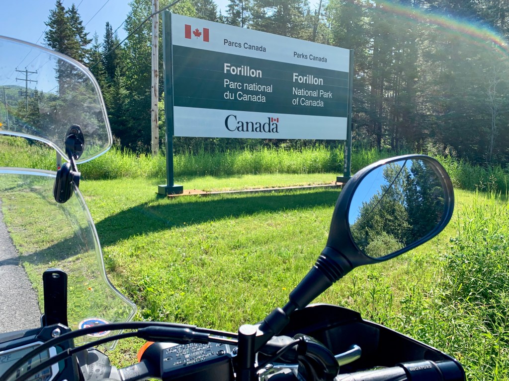
I rode out to what in my opinion is the jewel in the crown of the Gaspé, Forillon National Park.

Spread over almost 100 square miles along the easternmost, outermost tip of the peninsula, Forillon is a stunning, multi-ecosystem marvel that contains “forests, sea coast, salt marshes, sand dunes, cliffs, and the Eastern End of the Appalachians.” It’s also administered by Parks Canada, which does a humblingly great job from their website right down to their campsites.
I’d reserved a site for 2 nights, but skipped the first one because of the rain (when I stayed in Percé). But on the ride up, I actually received a call from a Parks Canada ranger…to check in, see if I was okay, and ask if I’d still be arriving.
It’s embarrassing to think that something like this—an actual call from a federal employee just to check on your well-being—would be, well, unthinkable in the lower 48.
But then, check out the bathroom/shower/kitchen facility at Forillon. I mean, this is a public parks building.

The Canadian government might not know what they’re doing with pot, but they sure have their shit together when it comes to this.

My tent site was on a bluff with a peek of the ocean, a sweet little grassy patch surrounded by trees and thick brush. It was also immaculate.

After tent-pitching, it was time for some off-bike, off-road exploring.

The specific part of Forillon where I was camping was Cap-des-Rosiers, or “Cape Rosebush.” Down a short gravel path from my site was the beach, stunning, lonely, and vast.

The only company was a gathering of Gannets patrolling the shallows, occasionally dive bombing for mackerel in the surf.

Otherwise, the crowds were a little thin.

After a meditative hour here, I set off to explore more of Forillon on the bike, riding down past Cap-Bon-Ami and out to Grande-Grave. I wanted to see if the road went all the way out to Shiphead, the “land’s end” of the Gaspé.
Around Cap-Bon-Ami, I had my second wildlife encounter of the trip. Again not a bear, but this little guy, quilling and chilling.
On Grande-Grave, I passed a cool 19th century building and stopped to check it out.

It turned out to be the Hyman General Store, a historical museum set up and stocked like the 19th Century sea-farer’s provisioner it once was.

Period kit…

Period provisions….

Period appliances.

A little reading revealed that this was the proprietorship of one William Hyman, a Russian-Polish- Jewish emigré to the Gaspé by way of New York. He not only built a thriving business here, but became the town reeve (or “magistrate”) of Cap-Des-Rosiers, the first Jew to hold elected office in Canada.

It was warming to realize that this motorbike-voyaging American grandson of German-Polish-Jewish emigrés (me) was hanging out in the well-worn shop of a ship-voyaging Russian-Polish Canadian Jew, centuries apart, two distant travelers separated by space and time, but united (and blessed) by their shared heritage, respective Gaspé journeys, and stunning summertime views like this:

I pressed on, riding out towards land’s end.
But I only got as far as this lovely cove; beyond it the road ended, and you could only reach the point on foot. My only regret from the entire trip was not walking it.

On my way back to Cap-Des-Rosiers, I picked up some firewood…

a few beers, and a couple of steaks.
Cheers to you, you Gaspé-journeying, surf-trunk-wearing, fire-stoking moto-Jew.

To wrap up the day, a twilight campfire… (that’s another Guided By Voices song, naturally)…
And so to bed, alone, stinking only mildly, and unafraid. I didn’t fear bears (or porcupines) here on Cap-Des-Rosiers, but only that moments like this—so simple, so quiet and so deeply gratifying—were too uncommon in life.
But then, isn’t that why we ride in the first place?
Day 5: Forillon, QE to Mont-Albert, Gaspésie National Park, QE
168 miles

And on the fifth day, God said “Let there be Lighthouse.”


Unfortunately, you had to pay a “phare” just to see it.

So I headed north and then west on 132, in search of freer adventures.

The north coast of the Gaspé—along the St. Lawrence River—is where the riding gets most interesting. Much of the coast is dominated by steep, scabrous (shale? limestone? sandstone?) cliffs tumbling down to the water, and occasionally into the roadway itself. The benefit of riding 132 counterclockwise is that, besides being on the outside lane of any rock avalanches, you have unobstructed views of the St. Lawrence. If there’s a whale to be spotted, you’ll spot it. I did not.
I rode through Saint-Yvon, Cloridorme, Petit-Anse, and around the town of Madeleine, stopping for some “poutine-lite” (aka American fries) and a grilled chicken sandwich—sustenance for the afternoon’s ride, which I’d be spending off-road.

Just past Madeline I made a hard left up a steep dirt road, with no real direction or destination in mind, just the intention of exploring. My destination for the day was the Gîte du Mont-Albert in the Chic Choc Mountains, over 100 KM southwest from where I was riding. I figured I’d do a little off-road dry run before the long dirt slog to Mont-Albert.
I wound up on a winding, hilly dirt road heading towards Lac au Diable.

In winter, it’s apparently something of a highway for snowmobiles.

But in summertime, I had the road all to myself…

Almost.
The first time I encountered one of these was a serious pucker moment. It didn’t seem like there was room enough for the two of us; he was hauling ass (in addition to logs); and the “shoulder” was loose scrabble right up to the woods.
With no option or exit plan, I just threaded it best I could, hoping I could clear the truck. I wasn’t counting on having to clear the dust contrail as well.
Little did I know I’d have to repeat this procedure a half dozen times on my way to and from visiting the Devil’s lake.
Nevertheless, it was a fun little warm-up. I essentially rode inland to the lake and back out to 132, an hour or so of dirt diversion.
Around the town of Marsoui, I decided it was time to undertake my inland journey in earnest. I really didn’t have much of a plan other than finding a dirt route up into the Chic Chocs and towards Mont-Albert, the tallest peak among them. So I again peeled off from the coast, heading inland on dirt. This is a handheld iPhone video at the start of it (I know, I know, dumb to ride one-handed while trying to film yourself, but I was stoked and wanted to capture the moment).
I’ve heard some folks say that as an ADV-bike, the Ténéré is like a piece of rudimentary farm equipment, fat, slow, unrefined, and with a motor that sounds like a tractor. I can’t disagree—but it makes me love my Tenner even more. What it lacks in horsepower and polish it more than makes up for in dead-reliability.
So I rumbled along, following my GPS to Mont-Albert along a route that appeared to be a legitimate road. But as I continued to ride that road became narrower…

the stream crossings grew lonelier…

and the woods became thicker and woolier.

I was probably two hours into this excursion when I started to experience a smoldering, low-grade panic.
What had started out as a road was increasingly becoming, well, first a two-track and then more of a path, and it wasn’t clear if this would simply just taper into nothingness deep in the woods.
I also no longer had any cellphone reception, and (stupidly) don’t carry a SPOT or other satellite emergency device. I hadn’t seen a truck, building, or another human being for hours. I was getting higher in elevation, with temperatures dropping noticeably. And I started to spook myself with the thought that with just one silly slip-up or mistake (like the spill I took in Utah that resulted in a smashed and broken ankle) I’d be S-O-L.
Alone, stinking…and starting to get afraid.
I imagined that, in the event of a crash, the only way I’d ever get my leg out from under my fallen 700-pound adventure bike would be having it gnawed off at the hip by a 700-pound adventure bear.
This spell of nerves called for a little off-the-bike situational assessment, here captured in a bit of selfie faux-bravado that masks my underlying “where the fuck is this going and will I even have enough fuel to get out?” hyperventilation.

If an ADVrider falls in the woods and starts to sob for his mommy like a hysterical four year old child, does it make a sound?
To be fair, though. I suppose this is what adventuring is all about. Wrestling these moments of self-doubt into a firm headlock, and then sitting them down until they behave; derailing that runaway train of disaster-thoughts so you can focus on the unfolding road before you, or the uneven ground beneath you; accepting the discomfort and uncertainty that comes when your electronic tether to the world is temporarily severed; and forcing yourself to press on and have faith that, at some point, the road will yield to some mark of civilization, a structure or power line or maybe even another vehicle-borne human being. And that in the end, half of the fun of getting where you’re going is scaring the shit out of yourself along the way.
As it turned out, I did not fall. I was not mauled. And the road that had trickled to a trail started gradually widening, flowing more rapidly until at the crest of a gentle rise the forest finally parted, and the still-snowy peak of my destination—Mont-Albert, all 3,776 feet of her—finally came into view.
I paused for a moment to honor my trusty steed, which always seems to see me through, nerves and all.

From here it was maybe another half hour of riding (the final part back on pavement) until I reached my lodgings for the night, the Gîte du Mont-Albert in the heart of the Chic Choc Mountains, and Gaspésie National Park.

While it had been a sub-200-mile day, much of it was off road, and I was tired, sore, and a bit frazzled. I’d been riding sun-up to sun-down for five days now, with my cumulative trip odometer tallying about 1,400 miles. Most of my clothes were pretty ripe; I needed a hot shower, a hot meal, and a washing machine.
Fortunately, the Gîte was happy furnish all three, but not before supplying a celebratory glass of crisp vin blanc.
Here’s to getting…uncomfortable. It makes the pleasure of very ordinary comforts so much more extraordinary.

Day 6: Mont-Albert, QE to Baxter State Park, Millinocket, ME
361 Miles

If my Gaspé road trip were a rocket flight, Mont-Albert was my apogee, the highest point of my trajectory. From here it was all geographically downhill, piloting gradually south and west, down through Quebec, down New Brunswick and down New England, to eventually make touchdown in Connecticut.
But first, I had about 1,000 glorious miles to cover.
I travelled along Quebec Route 299, the only other major thoroughfare on the Gaspé besides Route 132. But unlike the latter, which wraps the peninsula’s entire coastal circumference, Route 299 bisects it, running 137 kilometers from Sainte-Anne-des-Monts on the St. Lawrence, south along the Cascapédia River, until it hits Cascapédia–Saint-Jules on the Chaleur Bay.
Did I mention it was fucking gorgeous?

Apparently the Cascapédia is a world-class Atlantic salmon fishing destination. Along the way there are dozens of fishing camps and small river launches, usually featuring a lovely tethered (Old Town?) canoe.
It was weaving, winding riding heaven, and for most of the 85 or so miles of it I was blissfully alone.

But once you get to Cascapédia–Saint-Jules, you quickly re-enter civilization, including trucks, lights and traffic. I exited the Gaspé the same way I entered, crossing the Interprovincial Bridge and then wending my way down Route 17 towards Grand Falls, where I stopped to fill up my helmet.

It was p e r f e c t riding weather all the way down through New Brunswick, which is major potato-farming country. But after seeing a billboard for this…

I could not resist the temptation to stop at this.

Potato world is directly adjacent to McCain Foods, “the world’s largest producer of frozen potato products,” including—what else?—French Fries.
However goofy it looks, Potato World was actually a charming and informative little museum, showing and telling the history of the humble tater in New Brunswick.

But the museum’s real high point is its tidy little cafe, which serves an absurdly good l burger and what could only be described as world class fries—piping hot, crispy outside, light and potatoey inside, perfectly salted, and just, well, perfect. If this was my last supper, I’d be leaving this world a happy man.

A happy potato-man.

The remainder of New Brunswick was uneventful, including my return border crossing at Houlton. I was heading towards Baxter State Park in Maine, for another night camping.
I had initially intended to camp within the actual park, until I learned (thankfully online and in advance) that, by charter, the park allows entry of cars but no motorcycles of any sort. And since many of the campsites are miles deep into the park, you’d have to get a ride or hoof it.
So I’d reserved a site at the Penobscot Outdoor Center Campground in East Millinocket.
On the ride in, you pass dozens of signs for private family camps. I was pleased that some unknown branch of the family Prince had secured a patch of northern Maine for our clan.

I was only a little offended that I hadn’t been invited.
Not long past this I arrived at the Penobscot Outdoor Center, which has variety of woodsy sites along the river, including these canvas platform tents with camp cots and screen doors.

But I’d reserved a simple tent site on a flat, piney clearing just up from the river, and with a view of Mt. Katahdin. While it was totally serviceable, it was a far cry from the perfection of Forillon. The campgrounds had very basic, rough facilities: wooden outhouses, a somewhat prison-like concrete and timber shower area, and a “check-in” center featuring a crude peg-board system to keep track of the campsites, with hanging clipboards and hand-written reservation slips.
It was also about 11 miles away from any useable cell signal, with signs directing you back towards the Katahdin General Store in Millinocket if you needed to make an emergency call.
As per my email reservation confirmation (and the corresponding clipboard) I was in “Site 9,” which had been neatly raked from the fire pit to the tent area by the time I’d arrived, around early dusk.
So I pitched camp, hung my kit, started a fire, fired the JetBoil, opened a can of Chunky Sirloin Burger soup, and cracked open the Basil Hayden.

Sunset over Mt. Katahdin.

It had been an almost 400 mile day from the top of the Gaspé down to northern Maine, so I enjoyed a few minutes of fireside time…

And made use of my Amazon “skeeter-cheater” hat.

But by 9 pm I so thoroughly toasted it was lights out. I zipped into my sleeping bag and was snoring by 9:01.

Around midnight, something snapped me out of sleep.
At first my waking, panicked brain went to bear… until I heard it actually speaking.
“Hey. Um, excuse me. Uh, hello… umm, hello?!”
I unzipped my tent and stuck my head out into the darkness. It was welcomed by a flashlight shining directly into my face.
Shielding my eyes, I could make out a beater SUV idling up on the gravel road, and a rumpled, bearded, glassy-eyed guy standing between me and the truck. He continued (in annoyingly assholic fashion) shining the flashlight into my face.
Flashhole: “Uh, sorry but this is my site. You’re in my site. What happened to my tent?”
Me: “Uh, this is Site 9. Sorry. I reserved it. It’s on the board at the Welcome Center. My name’s on it.”
Flashhole: “No, man, my tent was right here. Been here for days. I was out hiking Katahdin and come back and now where’s my tent?”
Crouching there in the tent in “cow-pose,” clad only in boxers, and with just my glowing, flashlight-illuminated head sticking out from the zippered nylon front, I felt like a cornered turtle with a woefully inadequate shell.
Me: (trying to assess whether I was dealing with an idiot, a drunk, a drunken idiot, a guy high on his own stupidity, or a potential threat) “Sorry dude, definitely my site. Site 9. Me. My name’s on the board. Go check it. No idea where your tent is.”
This went back and forth like a Moebius strip, until finally I lost my patience and asserted “emi-tent domain” with an uncharacteristic, profanity-laden outburst.
“Listen dude, I have no fucking idea where your tent—or site—is. Go down and look on the fucking board or CALL THE FUCKING PENOBSCOT CAMP GUYS! I’m going back to fucking sleep!”
But as these words left my turtle mouth, my reptilian brain had not yet caught up with higher-level cognition (like situational awareness or the “impulsive language editor”), which should have reminded me that:
1) we were in the middle of the “fucking” North Maine woods
2) we were 11 miles from a “fucking” cell signal
3) I had exactly zero ability to call the “fucking” Penobscot Camp Guys, much less the “fucking” Millinocket police, and that
4) I, Mr. Naked Middle-aged Turtle Man in his lime-green shell had nothing but a folded Leatherman, a plastic coffee mug, and a spork with which to defend his emi-tent domain, much less his life.
Fuck.
Flashhole Guy just stared at me blankly, his light still blazing, the truck still idling, while a gentle chorus of peeping tree frogs and barking bullfrogs filled the night with their chatter, wondering what would happen next.
And with that, Mr. Naked Turtle Man retracted his head into his nylon shell, zipping it closed behind him. He lay flat upon his sleeping pad, silent and waiting, until the flashlight outside finally clicked off, a truck door opened and shut, and the sound of tires crunching on the forest floor telegraphed the visitor’s departure.
Now in total darkness, cocooned within his nylon shell, Mr. Naked Turtle Man reached down and gathered his sleeping bag around himself, staring up into the blackness, wide-eyed, blinking, and feeling very much alone. He listened to that familiar chorus of forest sounds, the peepers and bullfrogs, crickets and cicadas, singing their song of summer.
Mr. Naked Turtle Man lay there and listened, his soft belly rising and falling, the only other sound with the gentle wheeze of his own breath. And as he listened he also waited, anticipating the snap of twigs or crunch of tires that would announce the arrival of his former visitor, whom he was unshakably certain would be returning shortly to slash open his nylon turtle shell, stab at his naked, flailing turtle-man body, and disembowel him emphatically with a Bowie knife.
It was not a restful night.
Day 7: Millinocket, ME to Tuftonboro, NH
281 miles

I got up in the predawn darkness, exhausted but happy to have my bowels intact.
It’s funny that, with all of my bear-fixation, it never occurred to me that a different potential predator—the creepy human being—would be what kept me up all night.
But I was alive and unslashed, I had my JetBoil boiling and my portable Nespresso ready to squeeze out a couple of shots, it was a cool summer morning, and there was riding to do. So I caffeinated, decamped, saddled up, and headed down to the White Mountains in New Hampshire.
And as I pulled out of Baxter, I wondered:
Did Mr. Flashhole ever find his fucking tent?
The Maine Turnpike south from Baxter and the backroads over to New Hampshire weren’t particularly noteworthy. By late afternoon I was in the White Mountains, and soon after in Tuftonboro, arriving at camp for the night.
I had reserved a Tentrr site, which is kind of like AirBnB for the al fresco set. Tentrr—via an app—provides fully-outfitted platform tent sites on parcels of private property. This one happened to be part of a spectacular private homesite with its own swimming pond and meandering gravel drive.

The campsite itself consisted of a high quality platform tent, camp beds with air mattresses, a fire pit, grill, and just about every other camping amenity shy of making it “glamping” experience.

But the site itself wasn’t out on the open property; it was actually tucked into a small clearing in dense woods at what was actually a public trailhead for hiking up Mt. Shaw.
The moment I pulled off my helmet, I was assaulted by a cloud of mosquitoes and black flies almost as thick as the woods. So I grabbed my stuff from the bike and made a dash for the tent, throwing my kit inside and zipping-out the insect Air Force behind me.
Everything about the Tentrr site was immaculate. But something about the location kinda spooked me. Of all the places I’d camped on this trip, this felt the most remote and “beariest.” Maybe it was that the spot was at a trailhead, set back in the woods. Maybe it was the thick, piney White Mountains vibe. Maybe it was because the tent was several hundred yards from the nearest structure. Or maybe it was all the laminated plastic instruction sheets around the Tentrr site reminding visitors not to bring food into the tent; not to store garbage in or near the sleeping area, and to practice good bear hygiene.
Whatever it was, I just had a touch of the willies. I was still in my riding kit, sweating and stinking ripely. But I sat on the bed for a few minutes, fired up Google Maps, and searched “nearby motels.” There was Hampton Inn about an hour ride west in Concord. And before taking off my jacket I made an executive decision to skip my bear-obsessing and get an air conditioned room for my final last night.
Just a short ride from Tuftonboro is Wolfeboro right on Lake Winnipesaukee. The town was jammed with summer lake tourists, more concentrated humanity than I’d seen in over a week. I grabbed a quick sandwich but before heading out, I passed this little place, which stopped me in my tracks.

Besides my professional advertising life (and blogging about my motorbike rides), I also have a minor side-gig as a children’s author. And my first book (written over a decade ago when my kids were young) is called I Saw an Ant on the Railroad Track. It’s the story of a railroad switchman named Jack, who spies an errant little ant out for a walk…when a train comes along.
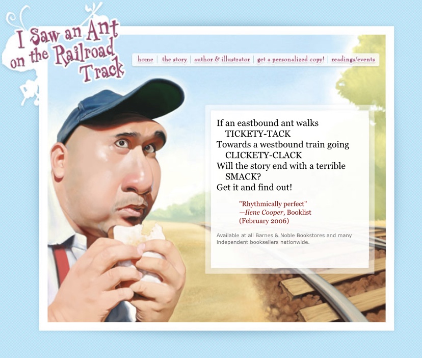
And since “Clickety-Clack“ is a recurring theme in the book, how could I not stop and check out the Klickety Klack Model Railroad Attraction Hobby and Gift Shop?

The place was like stepping into a live issue of Boy’s Life magazine, circa 1971. Estes Model rockets. Cox model airplanes. Tester’s paints. And of course, HO model trains, parts and accessories, from tracks and buildings to little miniature switchmen.

It’s one of those places that time and the internet have erased (or replaced), a dusty, idiosyncratic, lovingly-curated physical shop, as much about the proprietor (a septuagenarian gentleman wearing an old fashioned, cotton-ticking train engineer’s hat) as the assembled wares.
We had a nice chat and I told him about my book, which I promised to send him when I got home (I did).

I won’t bore you with the details of a night at the Hampton Inn, other than noting that the AC was frigid, the shower scalding, and that—after the night I had in Baxter State Park—I slept like the Percé rock.
Day 8: Tuftonboro, NH to Westport, CT
263 miles

The final leg of my journey started with the Free Breakfast Buffet! at the Hampton Inn, Concord. Curiously, all the food signs (and newspapers) were in Korean. And of the 75-odd people queued up for Froot Loops, Yoplait and robot waffles, I (along with what looked like a trio of gun show guys) was the only non-Korean.
Huh.
I asked the guy at the front desk about it, and he explained that this Hampton Inn somehow wound up on the itinerary of a South Korean bus tour company, and that several times each week, busloads of South Korean tourists disembarked there for the night, often taking up every room in the hotel. Concord was en route between Boston and Montreal, after which the buses returned to whence they came (New York).
So besides visiting French-speaking Canada, I had a little taste of Seoul on my ride, too.
The 260 mile ride home took me down the Interstate through New Hampshire, Massachusetts, and finally into Connecticut. I’d been riding for over a week, but given the long days and distances (and the fact that other than a few brief conversations with strangers, I’d been alone and hadn’t spoken much to anyone other than myself), it actually felt a bit longer.
By the time I passed New Haven, I started to feel some of the delirious glee that I supposed marathoners (like my son) feel when they know the finish line is within reach. I had to pee like a banshee, but I wasn’t going to stop until I made the turn into my driveway.
Which I did by late morning, immediately hopping off to unleash a long and liberating “al fresco” (as we call it) on the side lawn. I don’t think the neighbors could see, but after vibrating my bladder for the past 100 miles, I couldn’t care less.
Here’s mission control, with the final tally.

Just under 2,400 miles in eight days. Two countries, four states, a loop of the Gaspé, one moose, one porcupine, one buzzed (but not homicidal) Flashhole, a sentimentally-relevant toy train museum…and no bears.
Oh, and one worn-out rear tire.

The last page of my picture book goes like this:
Saved! Alive! Uncrushed! Off track!
An ant-sized pat upon the back
For poise and presence, and the knack
Of sniffing out a switchman’s snack.
So they lunched together,
Ant and Jack.
I kinda felt the same way, grateful to be home (alive! uncrushed!) but also alone (no one was home), stinking and less afraid than when I’d set out.
That’s the thing about long-distance riding. It doesn’t just thrust you out there to experience the wild, wooly world in all its raw, unfiltered glory. It forces you to confront your fears—about danger, crashing, strangers, uncertainty, self-reliance, aloneness, even bears—day after day, mile after mile until you demonstrate to yourself that you have the actual capacity to roll with them.
